
Description
Core Gameplay Loop
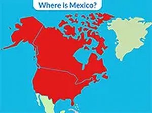
Players see the name of a country displayed on screen and must click the corresponding location on an unlabeled map of North America. Each correct placement reinforces spatial memory and geographic awareness. The interface stays clean and distraction-free, letting learners focus entirely on the map and the country names.
Map Coverage & Scope
The puzzle includes all 18 sovereign states and territories that make up the North American continent. From large nations like Canada and the United States to smaller islands such as Barbados and Cuba, every region appears in the rotation. This comprehensive approach ensures players build a complete mental map of the area.
Accessibility & Device Support
Because the game runs entirely in a web browser, it works on smartphones, tablets, laptops, and desktop computers without any installation. A full-screen mode helps users see the map more clearly on smaller screens. The simple click-based interaction works equally well with touchscreens and mouse inputs.
Learning Through Repetition
Regular play helps commit country locations to long-term memory. When a player selects the wrong spot, the correct location is briefly highlighted, turning each mistake into a learning opportunity. Over time, response times improve and accuracy increases, providing a clear sense of progress.
Family-Friendly Design
The game contains no advertisements, pop-ups, or external links, making it safe for children to use independently. Parents and teachers can trust that the experience remains focused on educational goals without unexpected distractions. The straightforward layout also suits older adults who prefer simple, no-frills interfaces.



Player Comments
Sign in to comment
You must be logged in before posting a review or rating.
No account? Create one
No comments yet. Be the first to comment!